
Trails
Hoh River Trail to the Lateral Moraine Viewpoint: Trip Planning Guide
Last updated:
A 37-mile out-and-back from Olympic's Hoh rainforest to the non-glacier Lateral Moraine viewpoint above Blue Glacier, with permits, camps, hazards, and itineraries.
 By Brooke5 min read
Share this post
Send it to someone who's planning a trip.
Overview
Why hike the Hoh to Blue Glacier
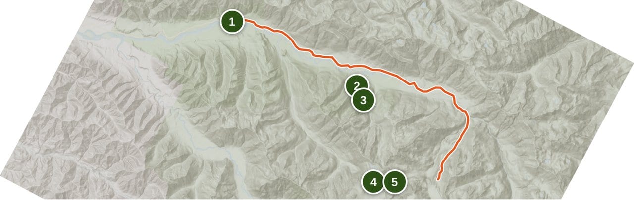
The Hoh River Trail moves from temperate rainforest to a non-glacier moraine viewpoint above Blue Glacier in one corridor. The NPS route page lists about 600 feet at the trailhead and 4,300 feet at Glacier Meadows, 17.4 miles from the start. WTA supplies the full-route planning figures: 18.5 miles one way, 37 miles round trip, 5,400 feet of gain, and a 5,100-foot high point at the Lateral Moraine viewpoint. The first 13 miles are generally flat according to NPS, followed by a steep upper climb. The route combines rainforest camping with alpine camping at Glacier Meadows, but permits, an approved animal-resistant food container, the avalanche-chute washout, and changing conditions all require advance planning. The hiking endpoint is the non-glacier Lateral Moraine viewpoint above Blue Glacier. Do not descend beyond the viewpoint or enter the ice.
At a glance
Trail at a glance
Days
3 to 5
Permit
Required for every overnight
Distance
37 miles round trip
Difficulty
Hard
Best season
Late June through September
Elevation gain
5,400 feet
When to go
When to hike
The NPS route page names late June through September as the nominal best season. Early-season snow can remain on steep slopes and may require an ice axe and navigation skill. NPS says winter travel above Elk Lake is not recommended because of steep avalanche chutes; it does not describe a formal winter closure. A permit date does not guarantee safe or passable trail. Check the wilderness trail conditions, current conditions, and road conditions close to departure because snow, fire, smoke, river levels, washouts, the ladder, and road access control trip decisions.
Permits & logistics
Permits & logistics
Permit
Olympic Wilderness Permit
Elk Lake, Martin Creek, Glacier Meadows, and every Hoh group and stock site are quota camps, so you must stick to your itinerary there. Other camps are first-come for permit holders, and NPS says gravel bars on the Hoh River make good low-impact sites. (NPS wilderness reservations and Hoh River Trail pages, checked October 17, 2026)
Requirement
Approved Bear Canister
A bear wire is not sufficient on this corridor. Follow the NPS wilderness food-storage rules.
A wilderness permit is required for every overnight stay, year-round. Review the official NPS wilderness reservation rules and reserve the exact named-camp itinerary through Recreation.gov. For the May 15 to October 15 season, reservations open April 15 at 7:00 a.m. Pacific. High-elevation camps book on a shorter season, typically mid-July to mid-October, so if early Glacier Meadows dates don't show, call the Wilderness Information Center at (360) 565-3100. You don't self-issue: staff issue permits booked more than a week out about 3 days before your trip, and then you log in and print yours. It costs $6 per permit plus $8 per adult (16 and older) per night; kids 15 and under are free. Elk Lake, Martin Creek, Glacier Meadows, and all Hoh group and stock sites are quota camps, so you can't change your itinerary there except in an emergency. Other camps are first-come for permit holders, and NPS says gravel bars on the Hoh River make good low-impact sites. Groups of 7 to 12 must use group sites, and 12 people is the most allowed. No campfires above Martin Creek, and no pets on the trail. (NPS wilderness reservations, Hoh River Trail, wilderness regulations, and pets pages, checked October 17, 2026) Every wilderness camp on this corridor requires a park-approved animal-resistant container for food, garbage, and scented items; follow the official NPS food-storage rules, and do not rely on a bear wire.
Getting there: Forks to the trailhead
The Hoh River Trailhead sits beside the Hoh Rain Forest Visitor Center at the end of Upper Hoh Road, roughly 20 miles southeast of Forks, Washington. From US-101, turn east onto Upper Hoh Road, signed for the Hoh Rain Forest, and follow it to the park boundary and visitor center parking.
The official NPS road table listed Upper Hoh Road open when checked October 17, 2026. Recheck it and the current conditions and alerts page before you drive, since closures and entrance delays change. The visitor-center area has services, but they end at the trailhead. Fuel, food, and last-minute gear belong in Forks or Port Angeles because there is no resupply on this out-and-back.
The Hoh developed campground near the visitor center is a frontcountry car-camp option. It does not appear on a wilderness permit itinerary.
Every named camp on the corridor
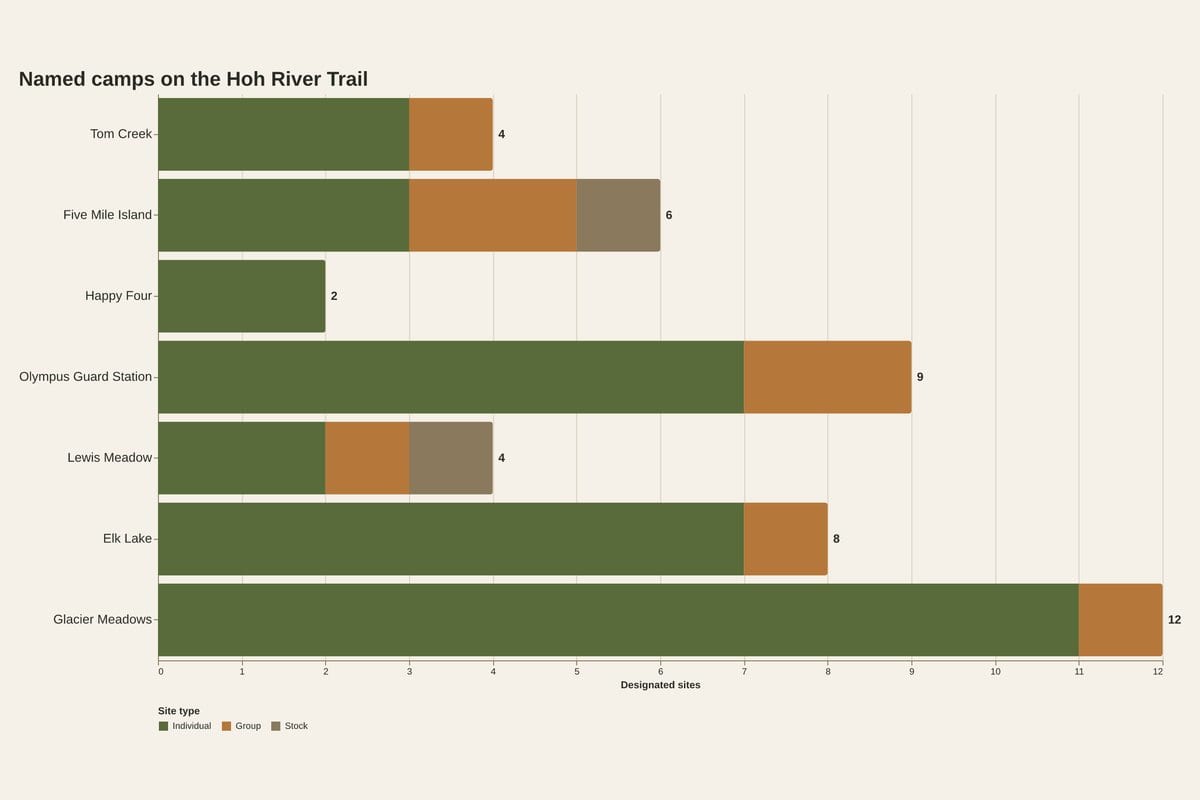
Your permit itinerary controls where you sleep at the quota camps: Elk Lake, Martin Creek, Glacier Meadows, and every group and stock site on the Hoh. Other camps are first-come for permit holders, and NPS says gravel bars on the Hoh River make good low-impact sites. Groups of 7 to 12 must use group sites, and 12 is the cap. No campfires above Martin Creek, and no pets on the trail (NPS, checked October 17, 2026). Review the NPS wilderness reservation rules and reserve through Recreation.gov.
| Camp | Mile | Sites | Privy |
|---|---|---|---|
| Tom Creek | lower corridor | 3 individual, 1 group | No |
| Five Mile Island | ~5.0 (approx) | 3 ind., 2 group, 1 stock | Yes |
| Happy Four | 5.8 | 2 individual | No |
| Olympus Guard Station | 9.5 | 7 ind., 2 group | Yes |
| Lewis Meadow | 10.3 | 2 ind., 1 group, 1 stock | Yes |
| Elk Lake | 14.8 | 7 ind., 1 group, 1 stock site 0.5 mi below lake | Yes |
| Glacier Meadows | 17.4 | 11 ind., 1 group | Yes |
The NPS route page supports the camp inventory, privy status, Olympus Guard Station at 9.5 miles, and Glacier Meadows at 17.4 miles. WTA supports the approximate 5.0-mile Five Mile Island figure and the 5.8, 10.3, and 14.8-mile waypoints. Tom Creek has no established mileage in the sources used here. Every camp requires a park-approved animal-resistant container for food, garbage, and scented items under the NPS food-storage rules; a bear wire is not sufficient.
For the May 15 to October 15 season, reservations open April 15 at 7:00 a.m. Pacific. High-elevation camps book on a shorter season, typically mid-July to mid-October (NPS, checked October 17, 2026). Permit availability at the quota camps controls the itinerary.
The upper trail: ladder, meadow, moraine
Past Elk Lake, the route leaves the generally flat river corridor and climbs into the cirque below the Olympus massif. The NPS route page gives elevations of about 600 feet at the trailhead and 4,300 feet at Glacier Meadows, 17.4 miles from the start. WTA supplies the full-route figure of 5,400 feet of gain to the 5,100-foot high point at the Lateral Moraine viewpoint.
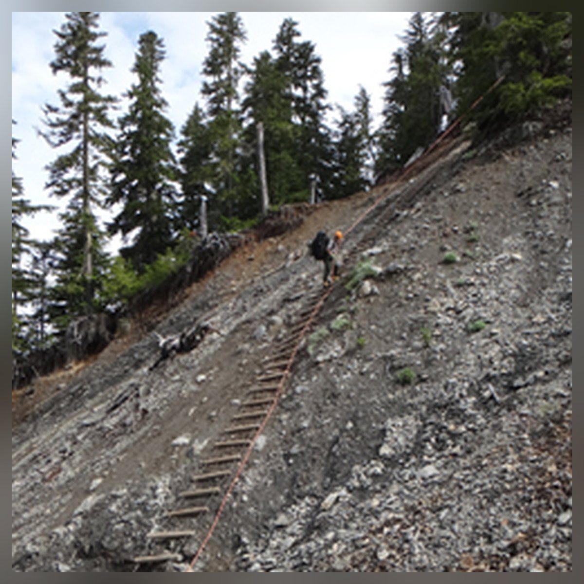
NPS describes an avalanche-chute washout 0.25 mile before Glacier Meadows with a rope ladder down a steep, loose-rock slope. Check the official wilderness trail conditions for current washout and ladder status before continuing.
WTA places the first Blue Glacier view near mile 17.5 and the Lateral Moraine viewpoint near mile 18.5. The safe hiking endpoint is the non-glacier viewpoint above Blue Glacier. Turn around there. Do not descend beyond the viewpoint, enter the ice, or cross the glacier.
Three itinerary patterns that add up to 37 miles
These patterns use the WTA full-route figures of 18.5 miles one way and 37 miles round trip, plus WTA waypoint mileages except for the official NPS 17.4-mile Glacier Meadows figure. Day and segment mileages are calculated planning values, not official measurements. Every pattern depends on exact named-camp permit availability.
3 days, 37 miles. Lewis Meadow base camp. Day 1: trailhead to Lewis Meadow, 10.3 miles. Day 2: day hike to the non-glacier Lateral Moraine viewpoint and back, 16.4 miles, including the steep upper trail and ladder. Day 3: hike out, 10.3 miles. Aggressive; the middle day is the hardest single day on the route.
4 days, 37 miles. Day 1: Lewis Meadow, 10.3 miles. Day 2: push to Glacier Meadows, 7.1 miles. Day 3: Glacier Meadows to the non-glacier Lateral Moraine viewpoint and back down to Lewis Meadow, 9.3 miles. Day 4: hike out, 10.3 miles. Still includes two 10-mile days but breaks up the upper trail.
5 days, 37 miles. Day 1: Happy Four, 5.8 miles. Day 2: Lewis Meadow, 4.5 miles. Day 3: Glacier Meadows, 7.1 miles. Day 4: viewpoint day trip, then back down to Elk Lake, 4.8 miles. Day 5: hike out, 14.8 miles. Shorter middle days and more rainforest time, but the final day is long.
Treat these as planning patterns, not promises. If the permit window only offers different camps, adjust among the named sites on your itinerary and re-run the arithmetic.
Conditions check before you go
Fire, smoke, burn bans, road status, and entrance delays can change daily, so check current conditions right before you go. When we checked on October 17, 2026, the NPS road table listed Upper Hoh Road open.
Before departure, check the NPS wilderness trail conditions for snow, river crossings, washouts, and ladder status; current conditions and alerts for fire, smoke, restrictions, and entrance delays; road conditions for Hoh access; and Recreation.gov for permit availability. Current reports, not the nominal season or a permit date, control the decision to start or turn around.
Trail breakdown
Trail breakdown
Trailhead to Five Mile Island
The opening miles follow the Hoh River through rainforest on gentle, often muddy tread. The NPS route page says the first 13 miles are generally flat and identifies a Hoh River braid crossing near mile 8. Five Mile Island is about five miles in by the approximate WTA waypoint. Check current river reports before departure.
Five Mile Island to Lewis Meadow
WTA places Happy Four near mile 5.8 and Lewis Meadow near mile 10.3. Between them, the NPS route page places Olympus Guard Station at mile 9.5. Treat the WTA waypoints as planning figures and the NPS guard-station mileage as the official route number.
Lewis Meadow to Elk Lake
The corridor continues toward the headwall. WTA places Elk Lake near mile 14.8. The NPS camp inventory lists seven individual sites, one group site, and a stock site half a mile below the lake. Winter travel above Elk Lake is not recommended because of steep avalanche chutes.
Elk Lake to Glacier Meadows
The NPS route page describes an avalanche-chute washout 0.25 mile before Glacier Meadows where a rope ladder descends a steep, loose-rock slope. NPS lists Glacier Meadows at 17.4 miles, with elevations rising from about 600 feet at the trailhead to 4,300 feet at the meadow. Check the official trail conditions for current washout and ladder status.
Glacier Meadows to the Lateral Moraine viewpoint
WTA places the first Blue Glacier view near mile 17.5 and the non-glacier Lateral Moraine viewpoint near mile 18.5. The viewpoint above Blue Glacier is the hiking turnaround. Do not descend beyond the viewpoint, enter the ice, or cross the glacier. Weather changes quickly on this exposed stretch, and the return uses the same upper-trail obstacles.
Highlights
What you’ll remember
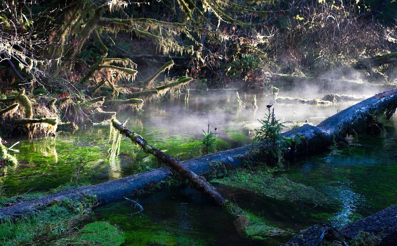
Hoh Rain Forest corridor
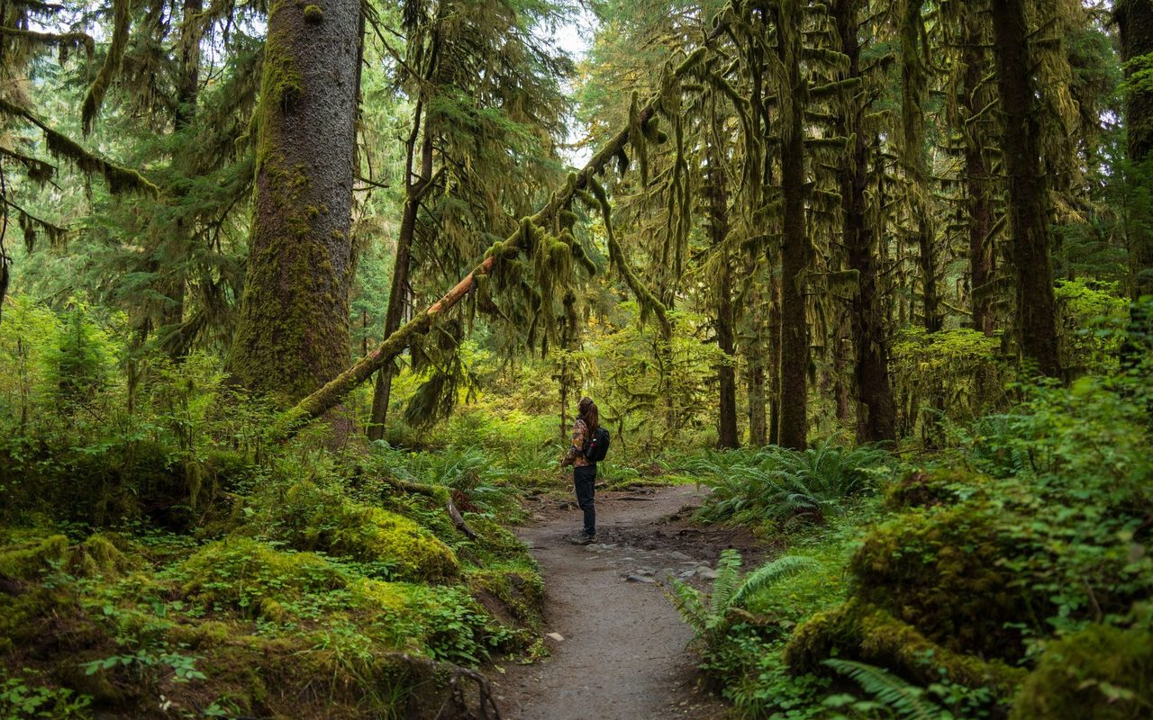
Thirteen flat miles under moss-draped old growth, with Roosevelt elk in the rainforest understory.
Five Mile Island
The corridor's first destination, about five miles in. Three individual sites, two group sites, one stock site, and a privy.
Olympus Guard Station
Mile 9.5. The largest mid-route camp with seven individual sites and two group sites, under old growth near the river.
Elk Lake camp
Mile 14.8. The staging point for the upper trail, with seven individual sites and a stock site half a mile below the lake.
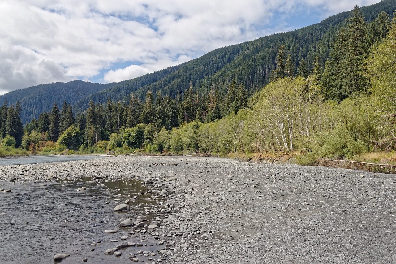
Glacier Meadows
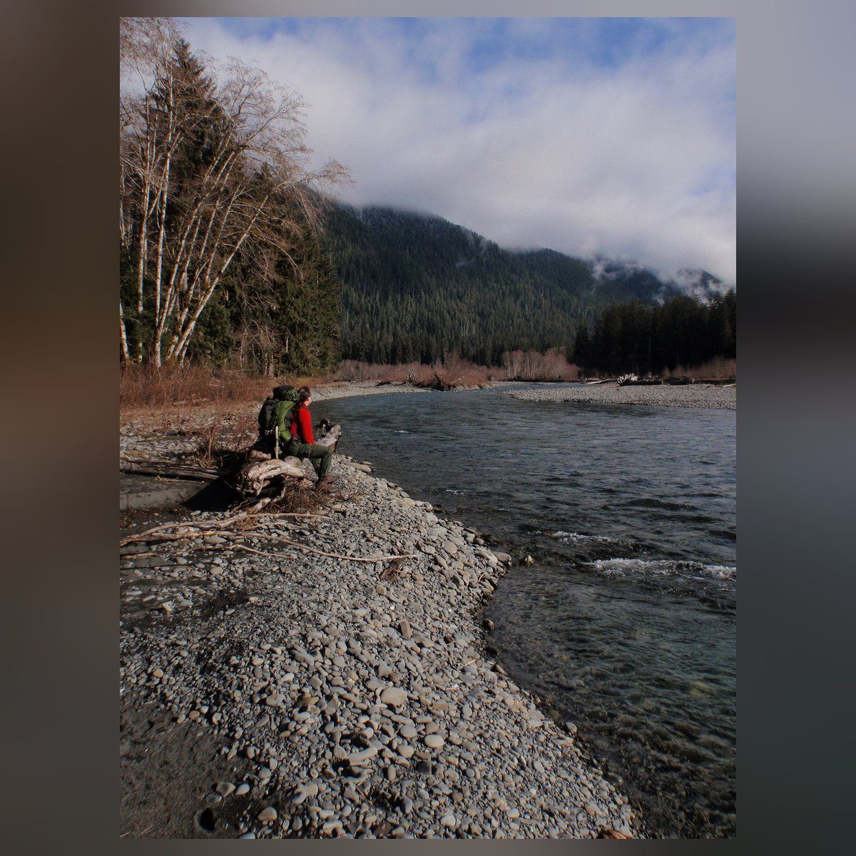
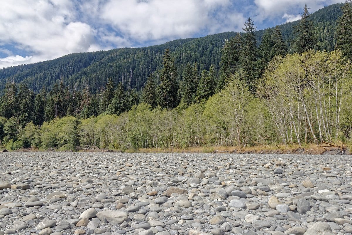
The Hoh River Trail corridor on the approach toward Glacier Meadows
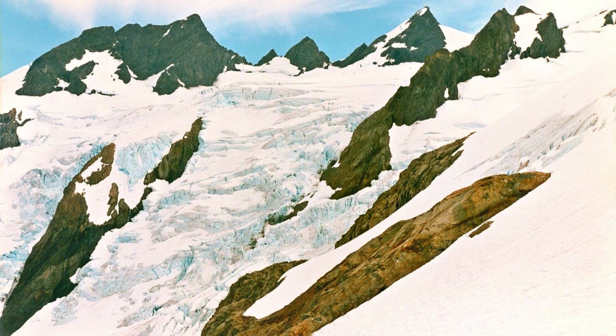
Blue Glacier from Lateral Moraine
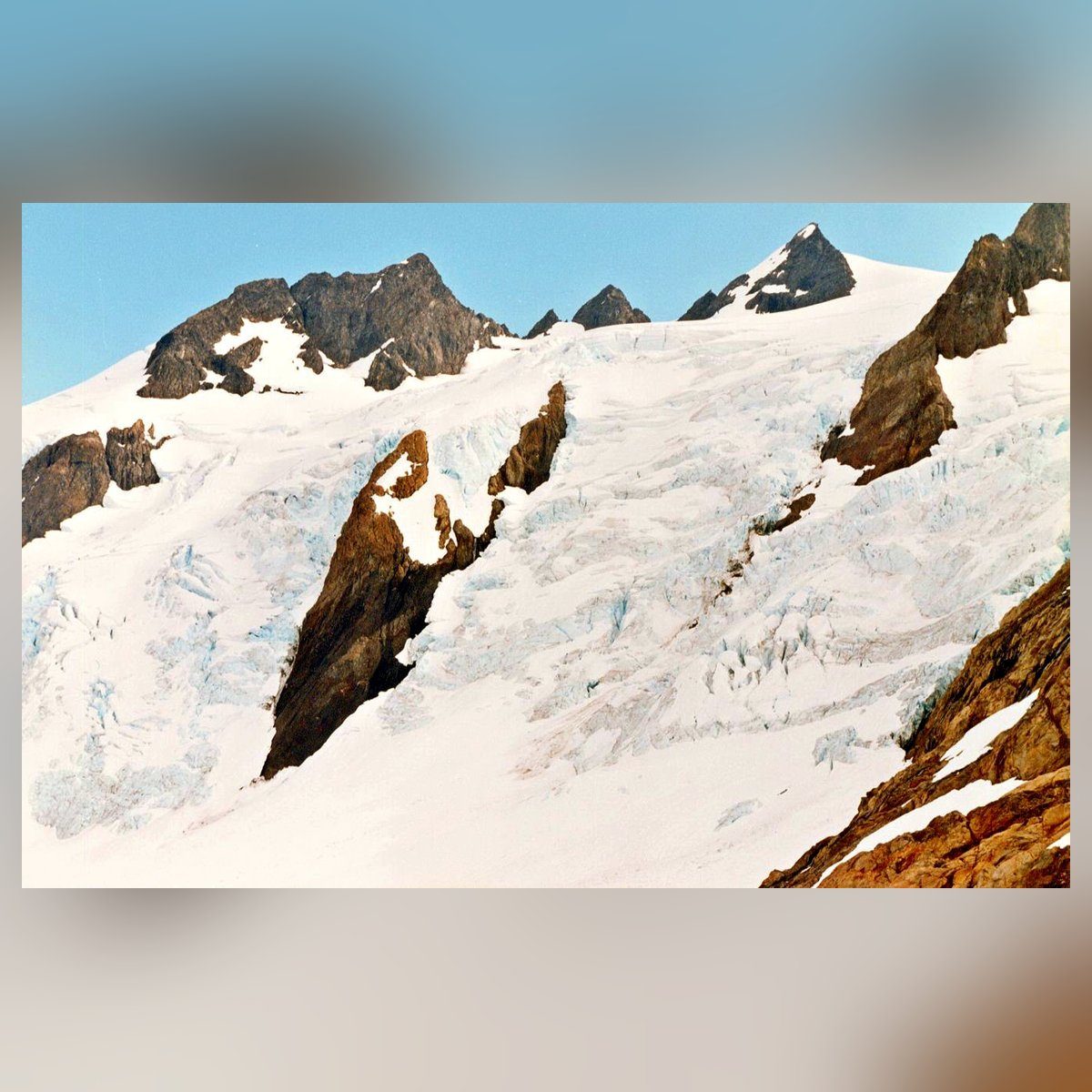
The turnaround near mile 18.5. Glacier views from the moraine shoulder only; the glacier itself is out of bounds for this route.
Hazards & safety
Hazards to plan for
Rope ladder at the avalanche washout
The NPS route page, last updated January 21, 2026, describes an avalanche-chute washout 0.25 mile before Glacier Meadows that requires a rope ladder down a steep, loose-rock slope. Check the official wilderness trail conditions for the current obstacle and ladder status before committing to the upper route.
Braided river crossing near mile 8
The NPS route page identifies a Hoh River braid crossing near mile 8 plus several small stream crossings. River level changes with rain and melt. Check current river and trail reports, and wait, find a safer crossing, or turn around if water is high.
Steep snow early in the season
Early-season snow can hold on the upper slopes and may require an ice axe and navigation skill. A permit inside the season is not a promise the snow is gone.
Avalanche terrain above Elk Lake in winter
The NPS route page says winter travel above Elk Lake is not recommended because of steep avalanche chutes. This is not a stated seasonal closure. NPS names late June through September as the nominal best season, but current snow and trail conditions control the decision to continue.
Fire, smoke, and entrance delays
Fire, smoke, burn bans, and Hoh entrance delays change through the season. Check the NPS current conditions and alerts page right before you leave. Campfires are never allowed above Martin Creek (NPS Hoh River Trail page, checked October 17, 2026).
No bailout: 37 miles the way you came
There is no road crossing and no shortcut out. An injury, washout, or high water means reversing along the same corridor to lower camps and the trailhead. Build turnaround criteria before you leave, and let someone hold your itinerary.
Waterborne illness
The corridor is water-rich, but NPS requires all drinking water to be boiled, filtered, or chemically treated. There is no authoritative camp-by-camp flow table, so carry between confirmed sources and never assume a named stream runs after floods or late-season change.
Resupply
Resupply points
| Stop | Mile | Services | Days to next |
|---|---|---|---|
| None on route | 0 to 37 | Carry the entire trip's food in an approved canister from the trailhead | 3 to 5 days, depending on itinerary |
None on route
- Mile
- 0 to 37
- Services
- Carry the entire trip's food in an approved canister from the trailhead
- Days to next
- 3 to 5 days, depending on itinerary
Retailer links on this page are affiliate links. We may earn a commission if you buy, and your price doesn't change. How affiliate links work →
Gear spotlights
What we’re recommending
For the no-signal miles
Satellite messenger
Garmin inReach Mini 3
If something goes wrong at Glacier Meadows, you're about 17 miles from the trailhead and a phone may not reach anyone. The inReach Mini 3 texts and sends an SOS over satellite. My review covers plans and battery.
Get one honest gear take every Friday.
One email a week: new reviews, one gear pick with my reasoning, and nothing sponsored. Confirm your address and you get my printable 2-page backpacking gear checklist.
You'll get a confirmation link first, and nothing else arrives until you click it. Every email has a one-click unsubscribe. How your email is handled
More from Trails

Rae Lakes Loop: A Backpacker's Trip Planning Guide
Planning the Rae Lakes Loop? Here's the honest read on permits, seasonal hazards, camps, bear-can rules, and how to choose between the Woods Creek and Bubbs Creek directions.
 Brooke Wilder
30 min read
Brooke Wilder
30 min read
Why trust BestForBackpacking
Honest gear advice for backpackers, researched, weighed, and recommended.
Every pick is based on deep research: a synthesis of long-term owner reports, independent reviewer tests, and manufacturer specs, weighted by source independence, specificity, and use-case match. Brooke Wilder is our gear editor, the editorial persona who turns that research into a clear recommendation.