Trail Guide
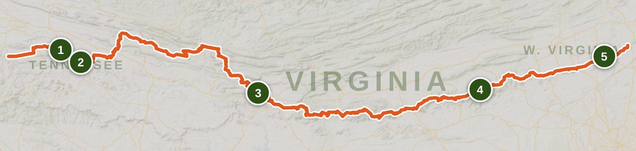
Appalachian Trail Virginia: Damascus to Harpers Ferry
Last updated: June 2026
Virginia spans 26% of the Appalachian Trail. Here is the complete section-by-section planning guide from Damascus to Harpers Ferry, covering Grayson Highlands, the Triple Crown, and Shenandoah.
![]() By Brooke6 min read
By Brooke6 min read
Share this post
Send it to someone who's planning a trip.
At a glance
Trail at a glance
Permits
Shenandoah NP: free backcountry, self-register
Distance
~550 miles (AT miles 467-1024)
Difficulty
Strenuous
Best season
April-June, September-October
Best direction
Northbound (NOBO)
Resupply stops
8+ towns on or near trail
Why Virginia?
Virginia is 26% of the Appalachian Trail. When you see that number as a thru-hiker looking at your map, it settles into something close to dread. When you see it as a section hiker, it becomes an invitation: more options, more terrain, more reasons to come back.
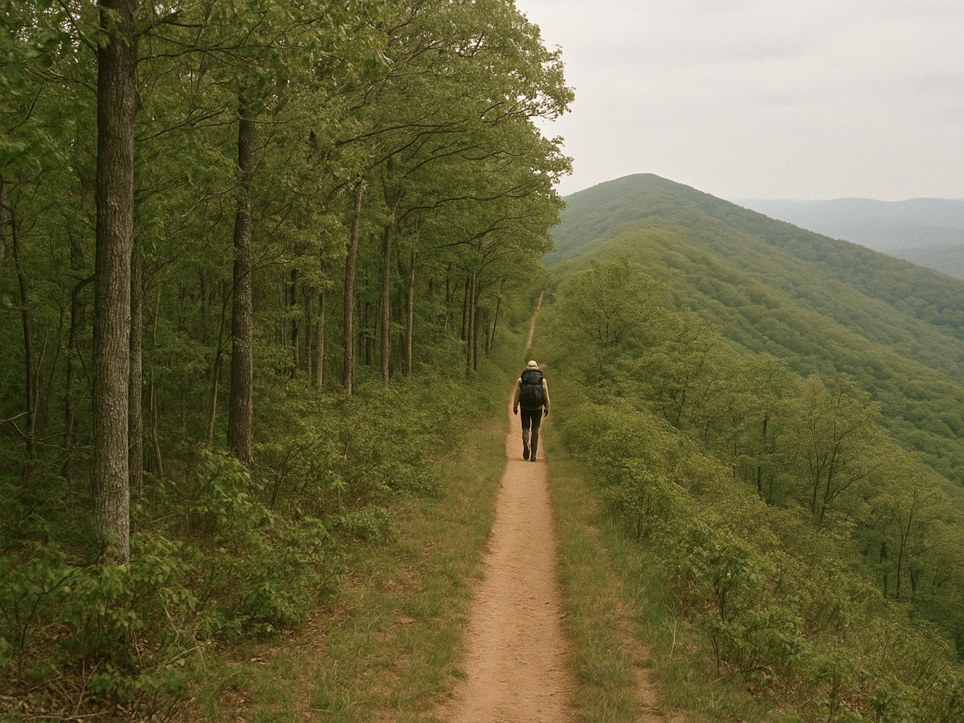
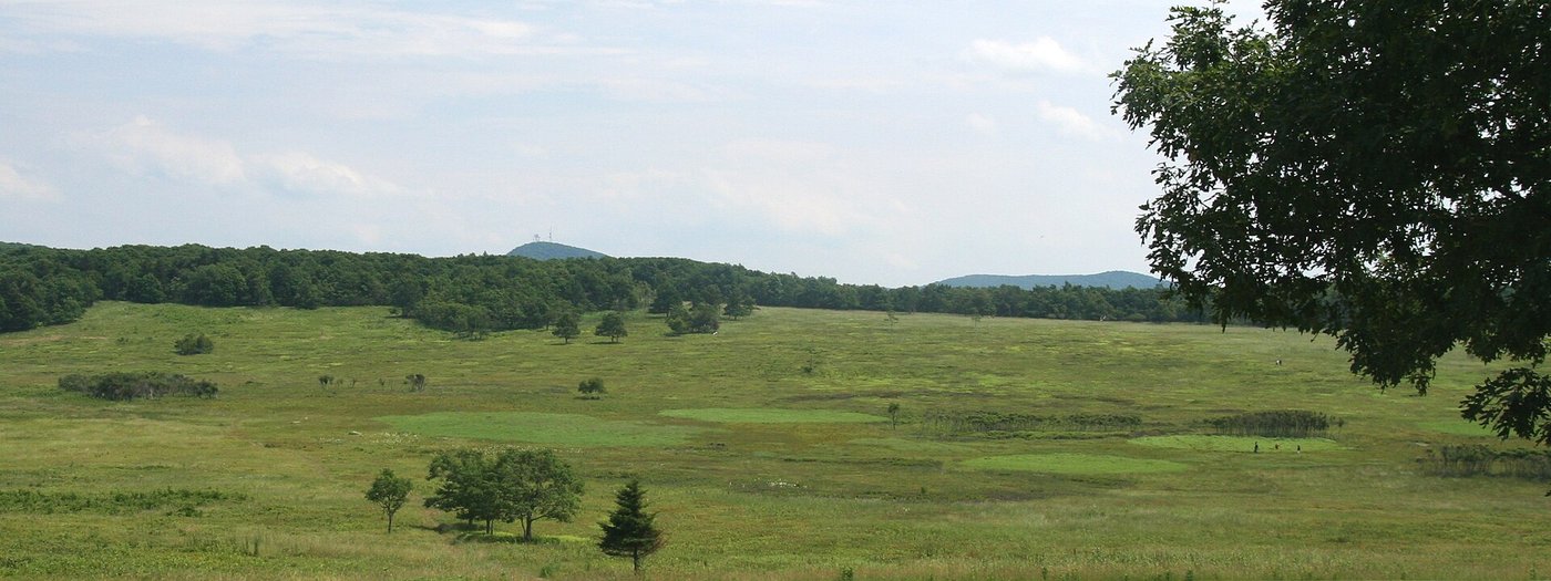
The Damascus to Harpers Ferry corridor contains everything the AT is known for in the eastern United States. Wild ponies roaming open balds at Grayson Highlands. The Triple Crown, a 30-mile arc of rocky summits above Roanoke that thru-hikers treat like a graduation ceremony. One hundred and one miles of Shenandoah National Park, where you can get a hot meal without ever leaving the trail.
It also has long ridge walks with no views and no towns, and a morale dip the community calls the Virginia Blues. This guide will give you both sides.
The Virginia Blues: What to Expect
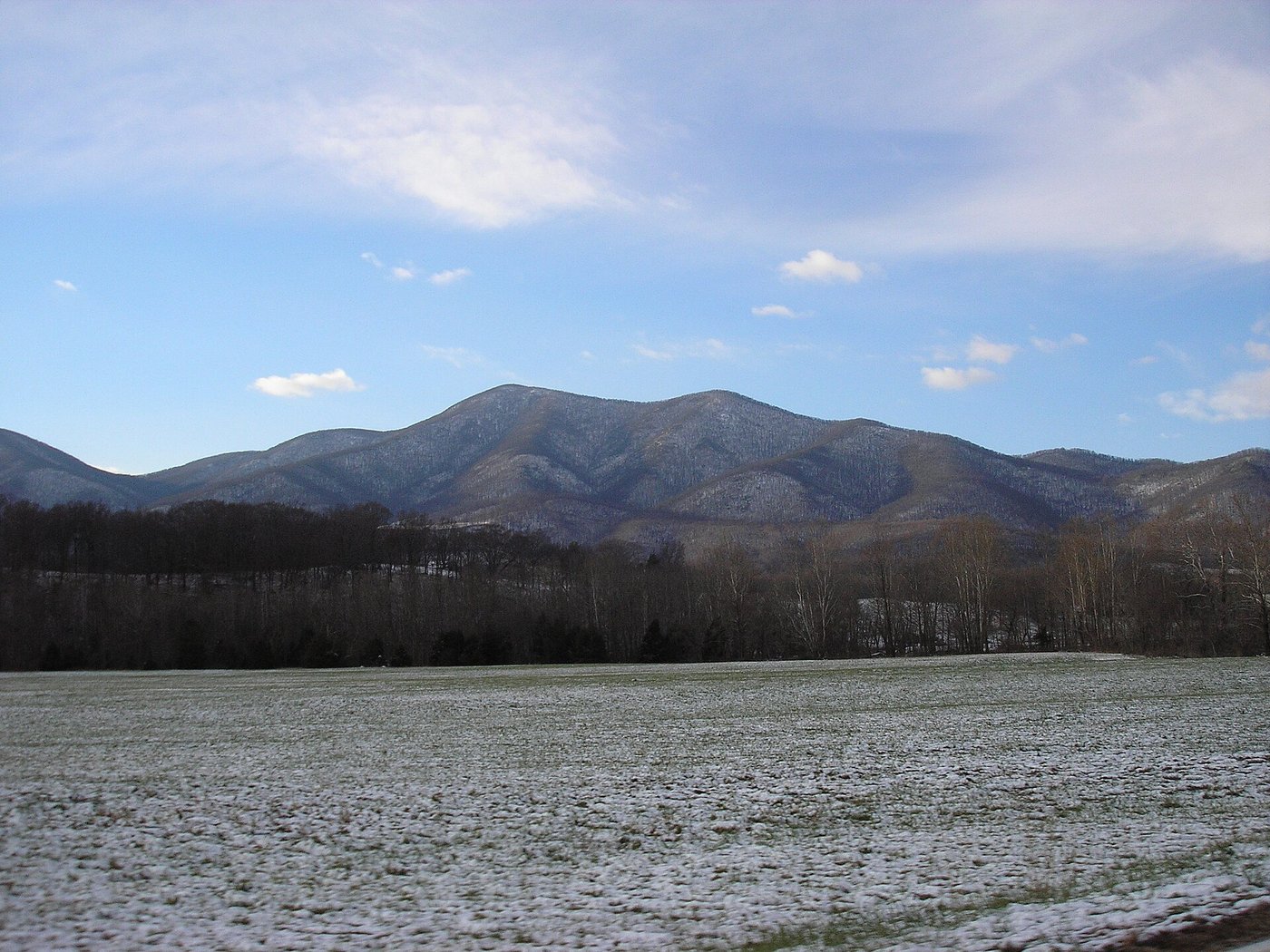
The Virginia Blues are not a myth. The middle section of Virginia's AT, roughly Marion to Pearisburg through Jefferson National Forest, is genuinely monotonous in a way the White Mountains or the Smokies are not. Long ridge walks with limited views, sparse town access, and in summer, real water stress on exposed ridges.
One 2025 thru-hiker described it plainly: the heat, the lack of water sources, and the trail starting to feel empty. That description is useful because it points to three concrete responses. Manage water carefully: carry 2-3L on every ridge day and check FarOut for current source conditions. Push the mental math toward the Triple Crown, which sits in the next section and is the most dramatic terrain Virginia offers. And plan a zero in Daleville when you arrive; Four Pines Hostel is free or by donation and one of the AT's most regenerating stops.
The Virginia Blues are a real thing. Planning for them takes most of their power away.
The Triple Crown: Virginia's Signature Arc
Dragon's Tooth, McAfee Knob, and Tinker Cliffs form the Triple Crown: three rocky summits in a 30-mile stretch above Roanoke between Catawba and Daleville. They can be hiked as part of a thru-hike or done as a dedicated three-to-four day section hike from Catawba trailheads with a car shuttle.
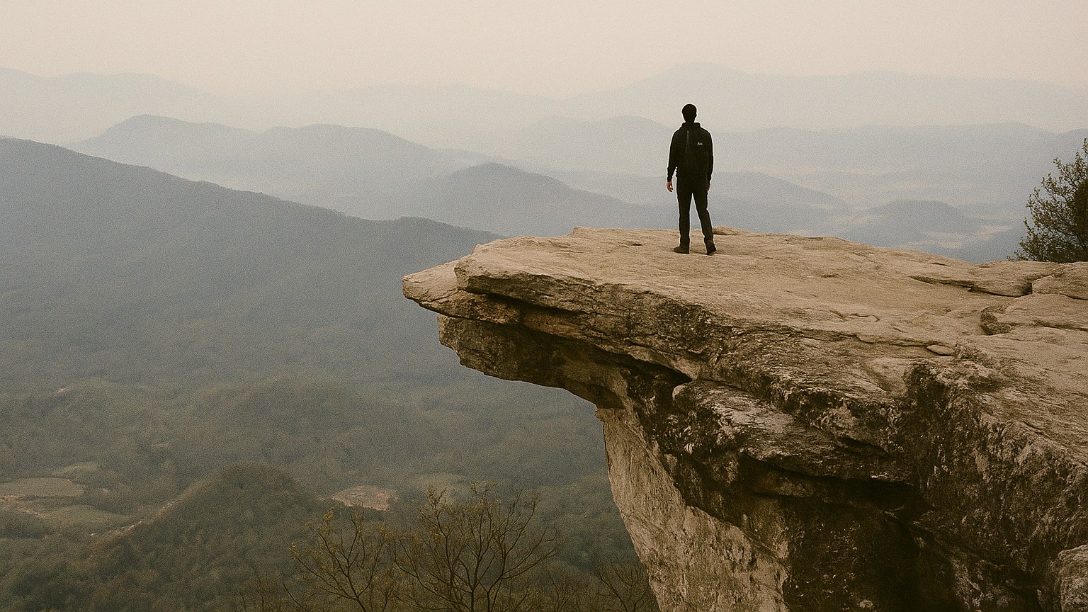
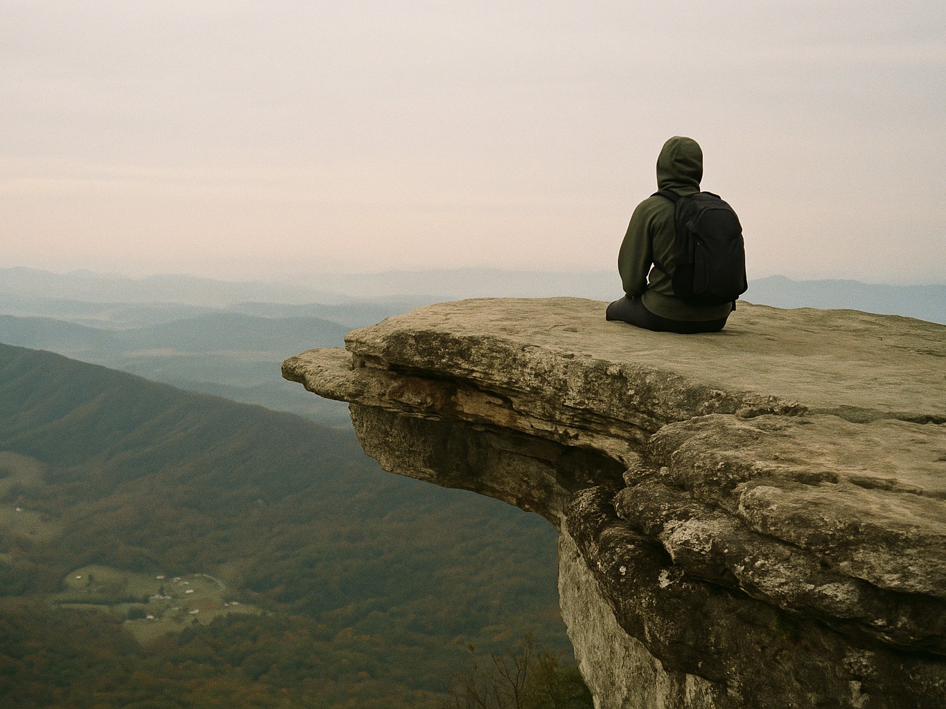
Dragon's Tooth is the most demanding. The approach involves a steep, rocky scramble with dramatic rock outcrops. The summit itself is enclosed by trees, but the ridge leading to it is the most technical terrain in Virginia south of the Whites. McAfee Knob is the crowd draw and the emotional center. The cantilevered ledge above the Roanoke Valley is the most photographed spot on the entire AT, and thru-hikers in 2026 were calling it among the best single views of their trip. Getting there for sunrise is worth adjusting your camp schedule; Campbell Shelter, the last reliable water before the knob, is the logical overnight stop.
Tinker Cliffs follows McAfee Knob northbound: a half-mile exposed ridgeline with sustained valley views. All three summits in one day is a long push; two days is more comfortable.
Triple Crown tattoos and social posts are a real cultural marker on the trail. Completing all three is Virginia's signature achievement, and Pearisburg to Daleville is the week to book if you want to do it right.
Which Section to Hike First
The most common question from Virginia section hikers: Pearisburg to Daleville for the Triple Crown, or the Priest to Front Royal for Shenandoah?
Pearisburg to Daleville (89 miles): Dragon's Tooth, McAfee Knob, Tinker Cliffs. This is the week with the most dramatic terrain and the strongest community identity. Payoffs come in concentrated bursts after the Pearisburg climb. Catawba's pastoral valley and Four Pines Hostel anchor either end. Choose this section if you want the Triple Crown and Virginia's signature visual moments.
The Priest to Front Royal (approximately 135 miles): This covers Three Ridges, the James River Footbridge, the Priest Shelter confessions register, and the full Shenandoah arc. It is quieter, more solitary, and better suited to hikers who want Shenandoah without the southern sections' crowds. The terrain is less concentrated on specific landmarks but cumulative and beautiful. Choose this if Shenandoah's waysides and historic culture are the draw.
For a first Virginia section hike, Pearisburg to Daleville is the stronger choice. For hikers who have already done the Triple Crown, Waynesboro to Front Royal through Shenandoah offers something entirely different.
Shenandoah National Park
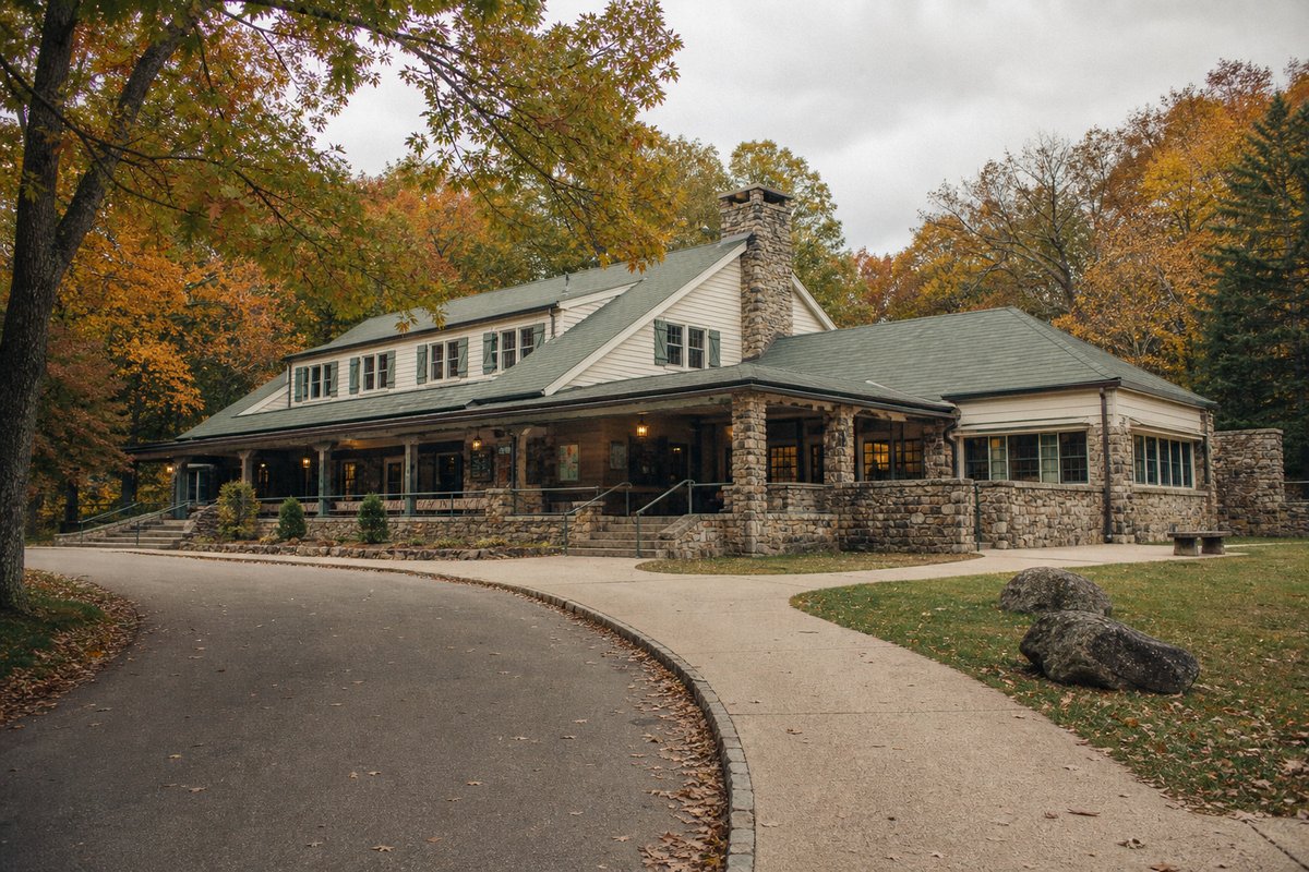
One hundred and one miles of AT inside a national park means infrastructure the trail rarely offers. The AT crosses Skyline Drive roughly 30 times between Waynesboro and Front Royal. Big Meadows Wayside, Skyland Resort, and Loft Mountain Wayside all have hot food and basic resupply within a short walk. This is one of the few places on the AT east of New England where you can sit down to a hot meal without leaving the corridor.
The backcountry permit is free and self-registration at trailhead kiosks. Hikers on foot entering via the AT pay no vehicle fee. Camping is restricted to designated sites and PATC-maintained Huts; dispersed camping is not allowed anywhere in the park. Verify current regulations at nps.gov/shen before departing.
Black bears are highly active here. Shenandoah bears are food-conditioned from decades of visitor traffic; they approach shelters and tents with confidence. Use the provided bear boxes at every shelter. The Bearfence Mountain scramble near mile 893 is the only 360-degree panoramic view in the park and worth the short detour.
Entering at Waynesboro and exiting at Front Royal is the cleanest logistics option for section hikers. Elkton and Luray are accessible with a road walk for mid-section resupply if the wayside options are not enough.
Damascus, Trail Days, and Trail Culture
Damascus calls itself Trail Town USA, and the town earns it. The AT passes directly through, and the community has organized itself around that fact for decades. The Place, a free hostel run by a Methodist church, has been hosting hikers since the 1970s. Hikers Inn and Woodchuck Hostel are paid alternatives. Multiple restaurants, a post office, and a gear outfitter round out the offering.
Damascus is also the northern terminus of the Virginia Creeper Trail, a ~34-mile rail-trail that runs southwest to Abingdon. It is a popular bike-and-shuttle day for hikers taking a zero in town.
Trail Days is the AT community's annual gathering, held in Damascus in the third week of May. It draws current thru-hikers, former thru-hikers, gear vendors, and AT alumni from across the country. If you are beginning a northbound section hike in late April or early May, you will be hiking with or just behind the Trail Days bubble; plan ahead, because shelters and hostels through the southern sections fill well in advance.
Trail magic in Virginia concentrates in the Shenandoah corridor, near highway crossings between Luray and Harpers Ferry. Fresh fruit, cold drinks, and protein snacks at road crossings are the most commonly reported forms. It is not guaranteed but it is part of the culture in this section.
On Mt. Rogers Outfitters in Damascus: this was the primary gear stop for the section for many years. Its operating status was unconfirmed as of mid-2026. Check via the outfitter's social media or recent FarOut comments before counting on it.
Highlights
What you’ll remember
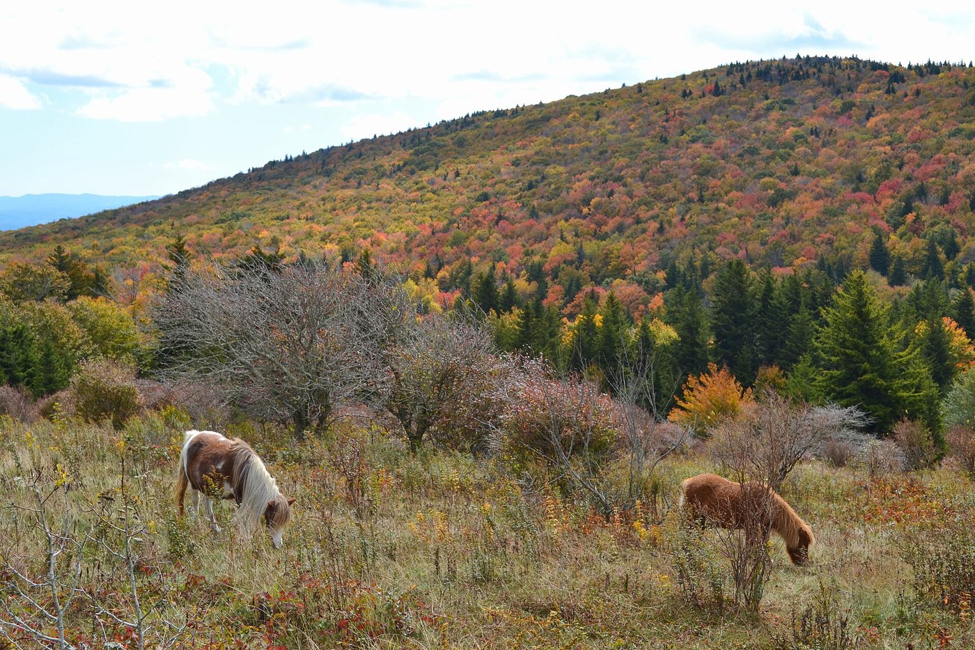
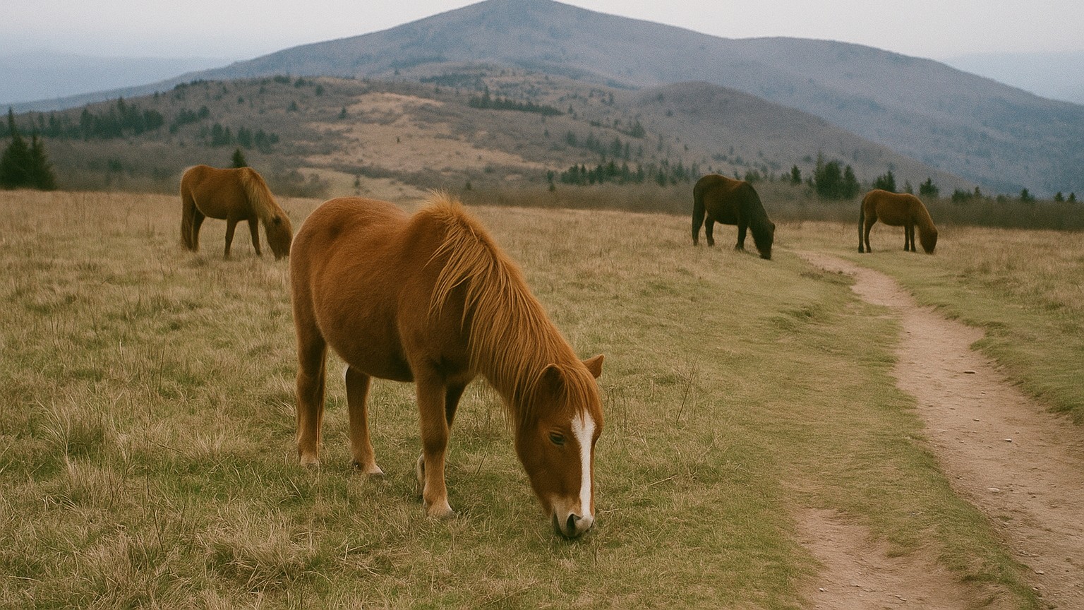
Grayson Highlands Wild Ponies
Free-roaming ponies on open balds in Grayson Highlands State Park. One of the most photographed moments on the southern AT, particularly in early morning light.
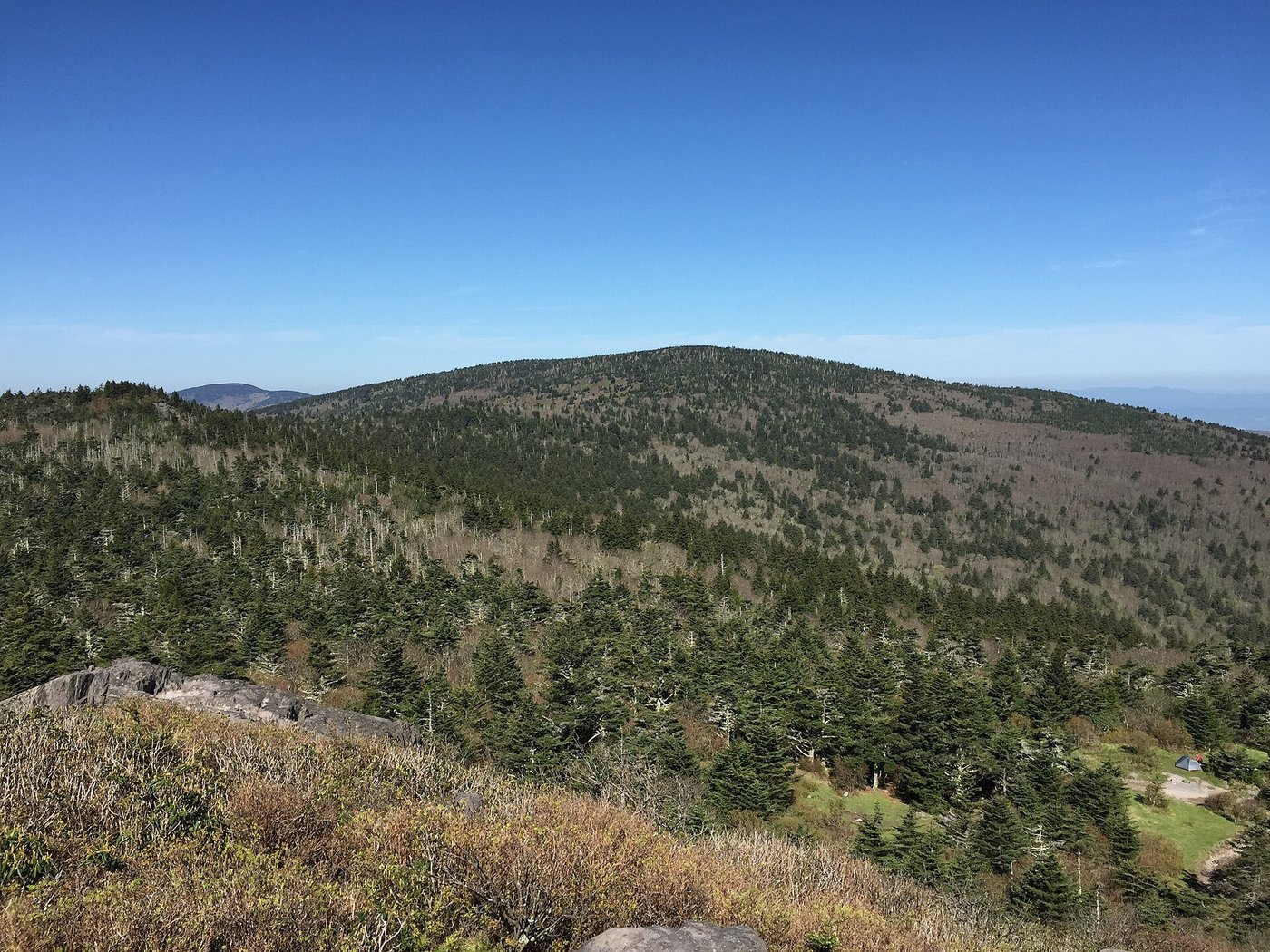
Mount Rogers Summit Approach
Virginia's high point at 5,729 ft. The summit itself is wooded, but the approach through Rhododendron Gap across open bald terrain is the real reward.
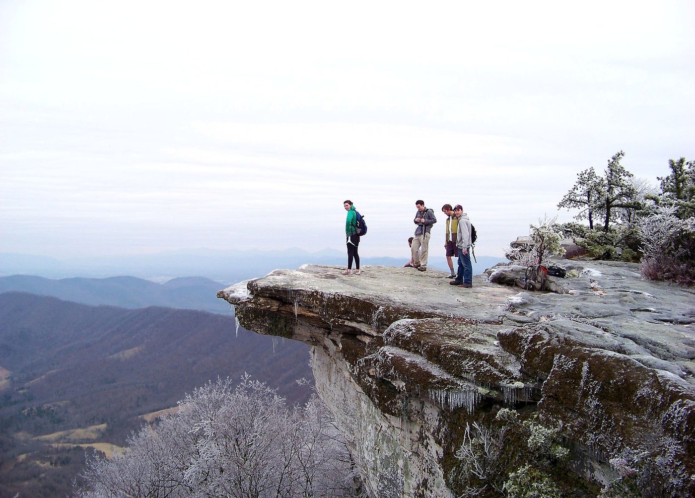
McAfee Knob
The most photographed overlook on the entire Appalachian Trail. The cantilevered ledge above the Roanoke Valley is worth an early start for sunrise.
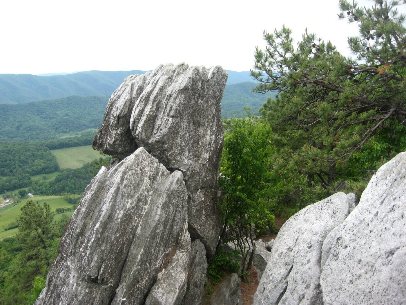
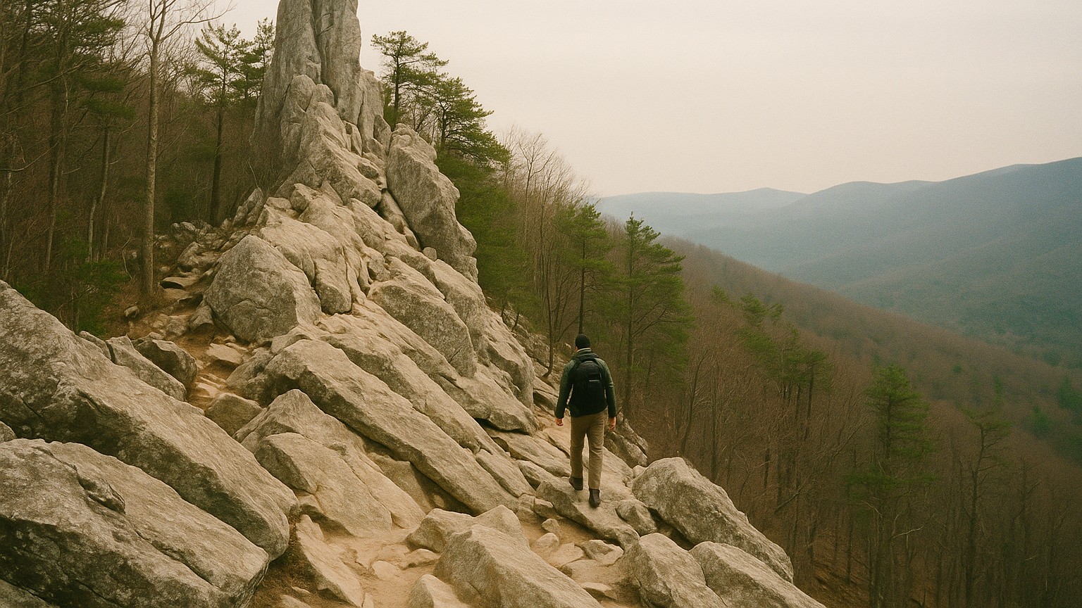
Dragon's Tooth
Virginia's rockiest climb. The summit is enclosed by trees, but the scramble approach is the most technically demanding mile in the state.
The Priest Shelter Confessions
A shelter register tradition where hikers leave anonymous confessions. One of the AT's most beloved community rituals, built up over decades of foot traffic.
Big Meadows Wayside
Hot food, showers, and resupply inside Shenandoah without leaving the trail corridor. The most significant morale reset available on Virginia's AT.
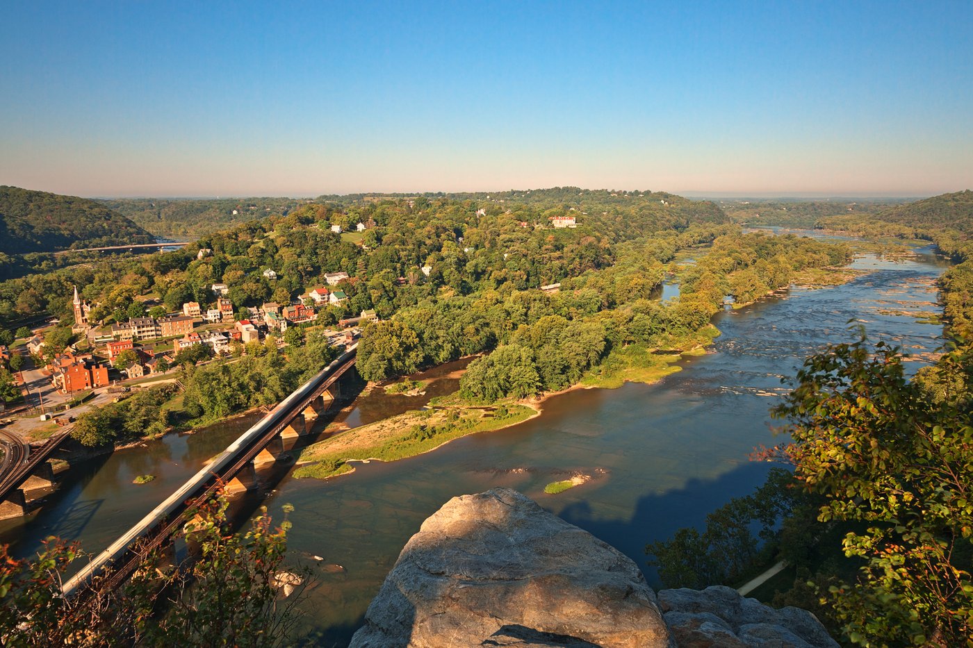
Harpers Ferry and ATC Headquarters
The AT's psychological halfway point. The Appalachian Trail Conservancy photographs every thru-hiker here, and the town itself is a rich layover stop.
Hazards & safety
Hazards to plan for
Dry ridges and water carries (Marion to Pearisburg)
Virginia's middle sections have the longest dry stretches on the AT east of the desert Southwest. Ridge walks of 8-12 miles without reliable water are possible in dry summers between Marion and Pearisburg. Carry 2-3 liters leaving any shelter on a high-ridge day. Check current FarOut reports before each ridge segment; springs that show as reliable can go seasonal in August.
Summer heat on exposed balds
Grayson Highlands, Whitetop Mountain, and the Triple Crown ridges have significant sun exposure. July and August temperatures on open ridges can be severe. Start early to finish exposed miles before midday heat builds. Signs of heat exhaustion include nausea, rapid heart rate, and confusion; descend to shade and water immediately.
Bears in Shenandoah National Park
Shenandoah has one of the highest black bear densities on the east coast. Bears are food-conditioned from decades of high visitor traffic and will approach tents and shelters. Use the provided bear boxes at all shelters. Do not store food or scented items in your tent. Follow park regulations strictly.
Late-season water in the southern ridge sections
The Mt. Rogers and Whitetop bald ridges, and the Walker Mountain and Brushy Mountain sections north of Marion, can have unreliable water in late summer. Even normally reliable sources can slow to a trickle or stop by mid-August. Carry extra capacity and verify FarOut comments for the specific ridge you are crossing.
Ice and snow at elevation in early spring
The Grayson Highlands balds and Mt. Rogers can have ice and snow well into April in a heavy winter. Most thru-hikers pass through in late April when conditions are clear, but early starters and late-spring storms can catch people off guard. Check recent FarOut comments and pack microspikes for any departure before May.
Get one honest gear take every Friday.
No spam. Just gear picks, packing lessons, and notes from this week's research.
Why trust BestForBackpacking
Honest gear advice for backpackers, researched, weighed, and recommended.
Every pick is based on deep research: a synthesis of long-term owner reports, independent reviewer tests, and manufacturer specs, weighted by source independence, specificity, and use-case match. Brooke Wilder is our gear editor, the editorial persona who turns that research into a clear recommendation.